Follow this link to go to the text only version of nasa.gov


Product Description

The RAQMS chemical forecasts are conducted online using a unified (stratosphere/troposphere) chemical mechanism developed at the NASA Langley Research Center. The meteorological forecasts are conducted using the University of Wisconsin Hybrid Model [Schaack et al., Global Climate Simulation with the University of Wisconsin Global Isentropic Coordinate Model, accepted for publication J. Climate, 2004].

Each RAQMS forecast begins with a 24hr "Hindcast". The hindcast is initialized at t-24hrs using NOAA GFS assimilated data and 24hr hindcasted chemistry from the previous RAQMS forecast run. This hindcast consists of a series of 6hr RAQMS forecasts, meteorological data is re-initialized with GFS analysis at 6hr intervals. The hindcast is followed by a 72hr RAQMS forecast, initized at 12Z.

Forecast products include 72hr 2x2.5 degree maps/xsections of CO, NOy, O3, and O3 P-L.

Continental US thumbnail

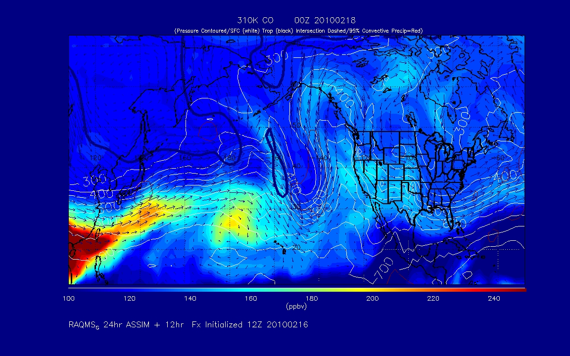
**conus_###K_YYMMDD.gif files cover the North American sector.

Colors indicate mixing ratios at three isentropic levels: 290K, 295K, and 300K.

When the respective isentrop is underground the surface mixing ratios are shown. The pressure of the isentrop is indicated by white contours. Horizontal wind vectors along the respective isentrops are also shown. The red contours enclose the regions with 6hr accumulated convective precipitation. The contour is equal to the precipitation amount which is in the upper 95th percentile of the convective precipitation over the North American Sector.

**conus_SFC_YYMMDD.gif files cover the North American sector.

Colors indicate surface (lowest model level) mixing ratios. Sea level pressure is indicated by white contours. The red contours enclose the regions with 6hr accumulated convective precipitation. The contour is equal to the precipitationamount which is in the upper 95th percentile of the convective precipitation over the North American Sector.

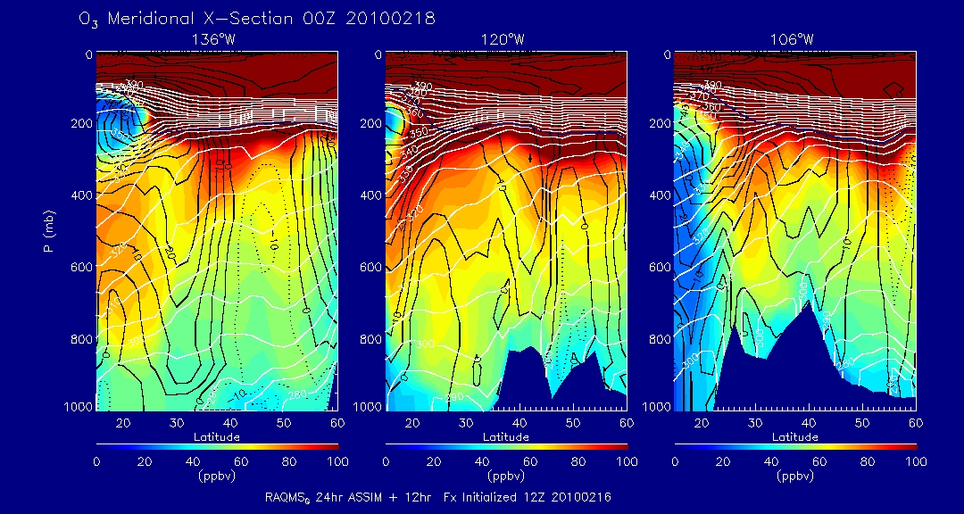
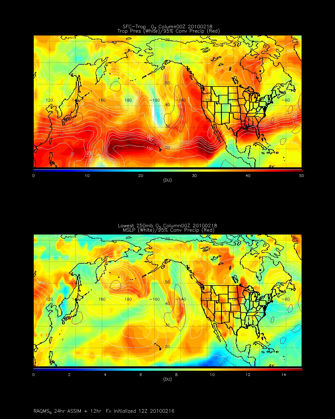
These forecasts focus on synoptic scale and convective transport from primary North American emission sources and are provided for NASA INTEX-NA flight planning. Wind vectors which are perpendicular to the pressure contours on an isentropic surface indicate regions of adiabatic ascent/descent associated with the moist and dry conveyor belts within baroclinic systems.


CO conus thumbnail

**xsection_YYMMDD.gif files show north-south cross-sections extending from 15N-70N at 130W, 70W, and 20W.

These forecasts are provided for the Lagrangian component of the ICARTT mission and to provide estimates of inflow/outflow patterns for INTEX-NA flight planning.


Columns thumbnail

**columns_YYMMDD.gif files cover North America-Atlantic-Western Europe sectors.

Colors indicate integrated column amounts between, 1) the surface and the tropopause (with tropopause pressure indicated by white contours), and 2) the lowest 250mb (with sea-level pressure indicated by white contours). The red contours enclose the regions with 6hr accumulated convective precipitation. The contour is equal to the precipitation amount which is in the upper 95th percentile of the convective precipitation over the North American Sector.

These forecasts focus on long-range transport and chemical transformation and are provided for the Lagrangian component of the ICARTT mission.


Surface Ozone Correlation thumbnail

TBS


Time series thumbnail

The site specific surface ozone concentration plot details the temporal behavior of the measurements made at a specific monitoring site location during the preceding 60 days. Correlations between the RAQMS observations and AirNOW measurements are also reported. The site name, metropolitan statistical area (MSA), and site identifier are reported on the chart. The left vertical axis is mass concentration of PM 2.5 (scale 0 - 100) and the right vertical axis is MODIS aerosol optical depth (scale 0.0 - 1.6). In-situ PM2.5 concentrations from continuous monitors are shown at an hourly frequency for both 1-hour (solid line) and running 24-hour (dashed line) averages.